
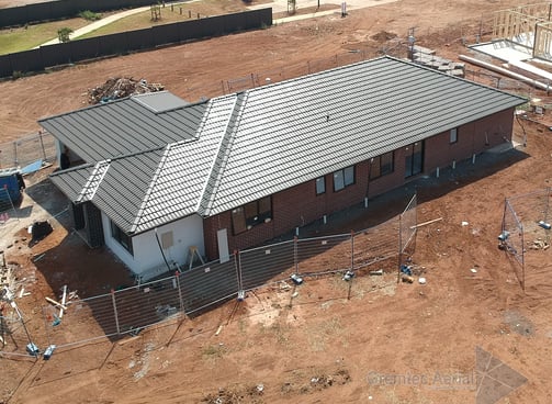
Aerial drone photography offers a different perspective on both construction progress and inspection of established properties. Gremtec Aerial can provide comprehensive progress photos as well as up close detailed inspections in those hard to access areas or from a new perspective

01
Progress and Inspection Photography


02
Real Estate Photography
Location is always key and what better way to demonstrate that location than with a set of professionally produced aerial shots. We will work with you to ensure we capture the features you want to highlight and provide a set a professionally produced and annotated photos to ensure your listing gets the attention it deserves


03
Mapping Capture and Generation
An Aerial Map will provide you with a unique perspective and detail that is not visible at ground level. We can provide you with high resolution accurate 2D maps with options to add 3D detail for structures and other important points of interest as required. We can provide exports in the format you require and to the detail you need to do everything from map authoring for emergency access and guidebooks to stockpile analysis and measurement.
SERVICES
04
Marketing Photography
Aerial drone photography is a great way to show off your business and highlight its location. Making a good impression is key and having a quality photo as the centerpiece of your businesses online presence is a great way to achieve that. Reach out to us to discuss ways we can help you boost your profile


